We leave from Pian di Nese, which is accessible from San Giovanni del Pantano or Umbertide. We start to climb through an abandoned agricultural area, characterized chiefly by Spanish broom, rockroses and junipers. At certain points, the shrubs give way to small wooded areas. We can immediately appreciate the hilly landscape of the area we are crossing, with the peak of Monte Acuto across from us, the north side of Monte Tezio behind us and, to the left, Cresta della Fornace and Colle Campana.
This rough and rocky trail leads to an unpaved road. We turn right, heading towards Umbertide along the level road that enters into a wooded area. This brings us to a natural terrace in the hamlet of Galera, where there are several lovely farmhouses overlooking a charming landscape. From this vantage point we can see the agricultural plains of the Tiber around Umbertide, the surrounding hillsides and, off in the distance, the Apennines. We bear left along a dirt track halfway up the hillside, cutting across the east side of Monte Acuto. Along the way, every so often we encounter beautifully renovated farmhouses.
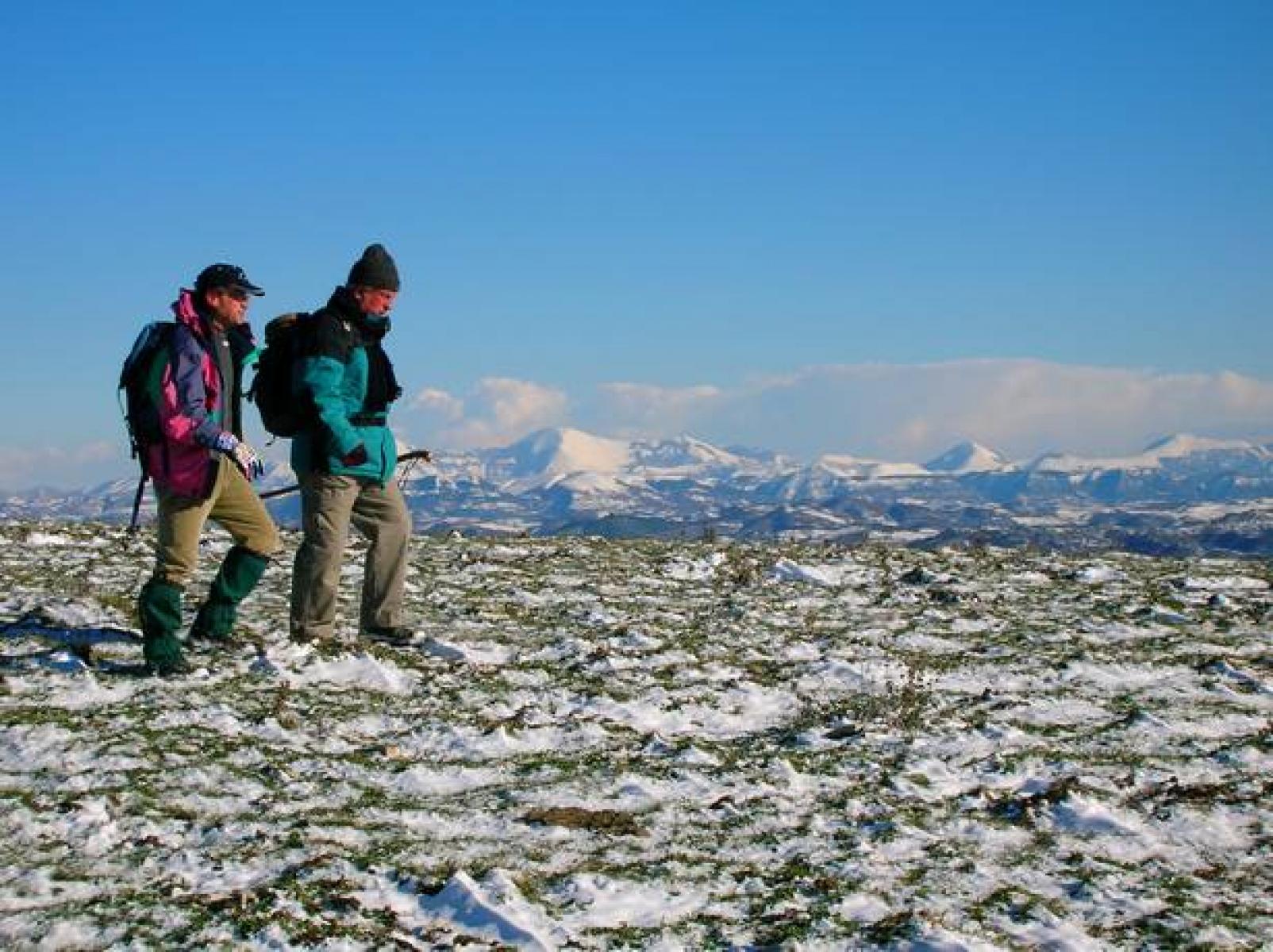
We continue to the built-up area of Montacuto and, following the signs, from here we take an uphill track that enters a heavily wooded area of oaks, hornbeams, manna ashes and holm oaks. Along this part of the route, we must pay attention to the signs and follow the main section of the track, which is barely visible at some points. We come to a glade, where several stones bear witness to the ancient presence of a castle or fortification. It is advisable to stop briefly before climbing the steep slope that, crossing a pine forest and then high meadows, brings us to the Cross of Monte Acuto. Cattle graze near the summit and the observation point here offers a 360-degree view of much of Umbria.
The panorama of the Apennines is breathtaking. We descend on the Perugia side and a winding, rocky road, which enjoys excellent exposure to the sun, takes us back to our starting point. Towards the end, we retrace our steps, taking the track we took when we set out.
The total length of the itinerary is 11.260 km.
 FILE GPX
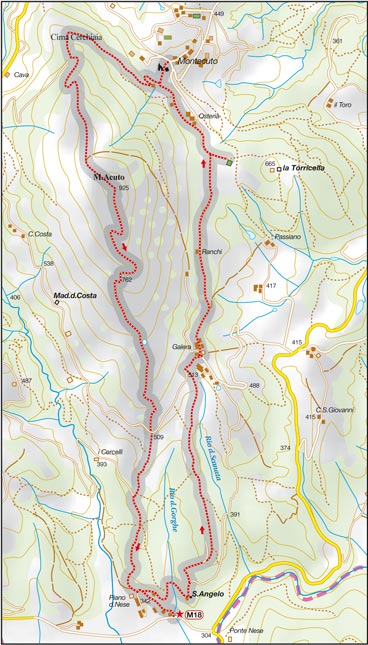 FILE MAP


